The Ultimate Guide: Top 5 Open-Source Tools for Advanced Spatial Data Analysis in Utilities
Master the integration of open-source spatial tools to optimize utility asset management and field Automation workflows. This guide provides industrial developers with a technical roadmap for building scalable, high-performance geospatial stacks using industry-standard open-source technologies.
- The Shift Toward Open-Source Spatial Ecosystems in Utilities
- 1. QGIS: The Extensible Desktop Powerhouse
- 2. PostGIS: The Backbone of Spatial Intelligence
- 3. GeoServer: Standardizing Data Distribution
- 4. PDAL: The Point Data Abstraction Library
- 5. WhiteboxTools: High-Performance Analytical Engine
- Technical Comparison of Open-Source Spatial Tools
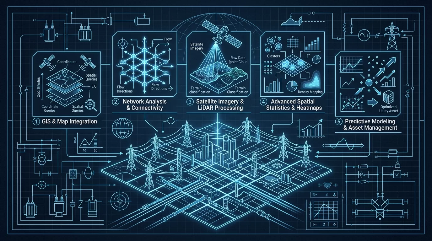
- Engineering Constraints: Integration and Scalability
- Conclusion
The Shift Toward Open-Source Spatial Ecosystems in Utilities
In the realm of utility management—spanning electrical grids, water distribution, and gas pipelines—spatial data is no longer a secondary concern; it is the primary driver of operational efficiency. Historically, this sector was dominated by monolithic, proprietary GIS platforms that often created data silos and incurred prohibitive licensing costs. Today, Industrial Software Developers are pivoting toward open-source stacks to gain the flexibility required for real-world engineering constraints, such as edge computing, real-time sensor integration, and automated vegetation management.
As a Field Automation Engineer, I have seen that the most robust systems are those that leverage specialized tools for specific layers of the spatial stack. Below, we analyze the top five open-source tools that are redefining advanced spatial data analysis for modern utilities.
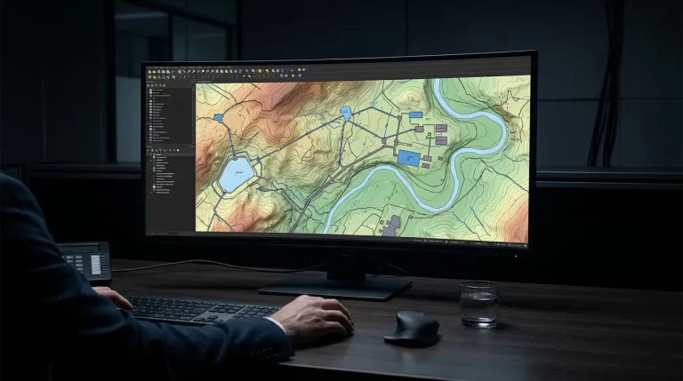
1. QGIS: The Extensible Desktop Powerhouse
While often viewed as a simple desktop viewer, QGIS (Quantum GIS) serves as the primary IDE for spatial data. For developers, its true power lies in the PyQGIS API and its ability to integrate directly into CI/CD pipelines for automated map production. In utility contexts, QGIS is used to simulate network topologies and visualize the results of hydraulic or electrical load flow analyses.
- Key Strength: Massive plugin ecosystem (e.g., GRASS, SAGA integration).
- Utility Use Case: Visualizing SCADA alarm heatmaps over asset locations to identify localized equipment failures.
2. PostGIS: The Backbone of Spatial Intelligence
No advanced spatial stack is complete without PostGIS. It turns the PostgreSQL object-relational database into a spatial database capable of complex geometric queries. For developers building B2B utility applications, PostGIS is essential for handling concurrency, data integrity, and complex spatial relationships that standard NoSQL databases struggle with.
PostGIS allows for server-side spatial analysis, reducing the need to move massive datasets over the network. For instance, calculating the proximity of a new transformer to existing high-voltage lines can be done with a single SQL query.
-- Example: Identifying power poles within a 10-meter buffer of a reported vegetation encroachment
SELECT poles.id, poles.geom
FROM utility_poles AS poles, vegetation_zones AS veg
WHERE ST_DWithin(poles.geom, veg.geom, 10)
AND veg.risk_level = 'High';
3. GeoServer: Standardizing Data Distribution
GeoServer acts as the middleware that bridges the gap between your spatial database and your web or mobile applications. It implements Open Geospatial Consortium (OGC) standards like WMS (Web Map Service) and WFS (Web Feature Service). In a utility environment, this allows field technicians to access real-time asset data on mobile devices while ensuring that the data adheres to strict organizational schemas.
One of its most critical features for developers is WFS-T (Transactional WFS), which enables field devices to send geometry updates (like a newly installed meter) directly back to the master database with full ACID compliance.
4. PDAL: The Point Data Abstraction Library
With the rise of LiDAR-equipped drones for line inspections, utilities are drowning in point cloud data. PDAL is the “GDAL for point clouds,” providing a robust C++ library and command-line application for translating and manipulating point cloud data. For advanced spatial analysis, PDAL is used to automate the detection of vegetation encroachment near power lines by filtering points based on height and proximity to wire geometries.
- Key Strength: Pipeline-based processing for massive datasets.
- Utility Use Case: Automated classification of ground vs. non-ground points to generate Digital Terrain Models (DTM) for new pipeline routing.
5. WhiteboxTools: High-Performance Analytical Engine
WhiteboxTools is an advanced geospatial data analysis engine developed in Rust, designed specifically for environmental and hydrological applications. In the utility sector, it is increasingly used for flood risk assessment for substations and watershed modeling to protect water utility intake points. Its performance is significantly higher than traditional GIS tools because it is designed for parallel processing from the ground up.
Technical Comparison of Open-Source Spatial Tools
The following table summarizes the technical positioning of these tools within a utility software architecture:
| Tool | Primary Function | Core Language | Best For… |
|---|---|---|---|
| QGIS | Desktop Visualization | C++ / Python | Manual data QA and cartography |
| PostGIS | Spatial Storage & Query | C / SQL | Complex spatial relationships and indexing |
| GeoServer | Web Service Delivery | Java | Serving OGC-compliant data to web apps |
| PDAL | Point Cloud Processing | C++ | LiDAR analysis and vegetation management |
| WhiteboxTools | Geomorphometric Analysis | Rust | Hydrological modeling and terrain analysis |
Engineering Constraints: Integration and Scalability
When deploying these tools in a B2B utility environment, developers must consider Coordinate Reference Systems (CRS). Utilities often operate across vast geographic areas where precision is paramount. Using a global CRS like WGS84 might be fine for visualization, but engineering-grade calculations (like pipe slope or wire sag) require local projected systems. PostGIS and GDAL (which underlies QGIS and GeoServer) provide the industry-standard PROJ library to handle these transformations with sub-centimeter accuracy.
Furthermore, security is a non-negotiable constraint. Unlike consumer mapping apps, utility maps contain Critical Infrastructure Information (CII). Implementing GeoServer with Role-Based Access Control (RBAC) and ensuring PostGIS is isolated within a VPC are standard practices that industrial developers must implement to protect the grid.
Conclusion
The transition to open-source spatial tools allows utility companies to move away from vendor lock-in and toward a more agile, developer-centric infrastructure. By combining the storage power of PostGIS, the delivery capabilities of GeoServer, and the analytical depth of PDAL and WhiteboxTools, developers can build systems that are not only cost-effective but technically superior to legacy proprietary solutions. The key to success lies in understanding the specific strengths of each tool and integrating them into a cohesive, automated pipeline.